At the beginning of September, our researcher Dr Yvonne McFadden took a trip up to the hills above Patna to visit the site of the villages of Burnfoothill and Lethanhill.
Before ascending up the bumpy road to the villages, I spotted a plaque at the turn off from the A713 outside Patna. A good sign I was on the right track to the ‘Hill.
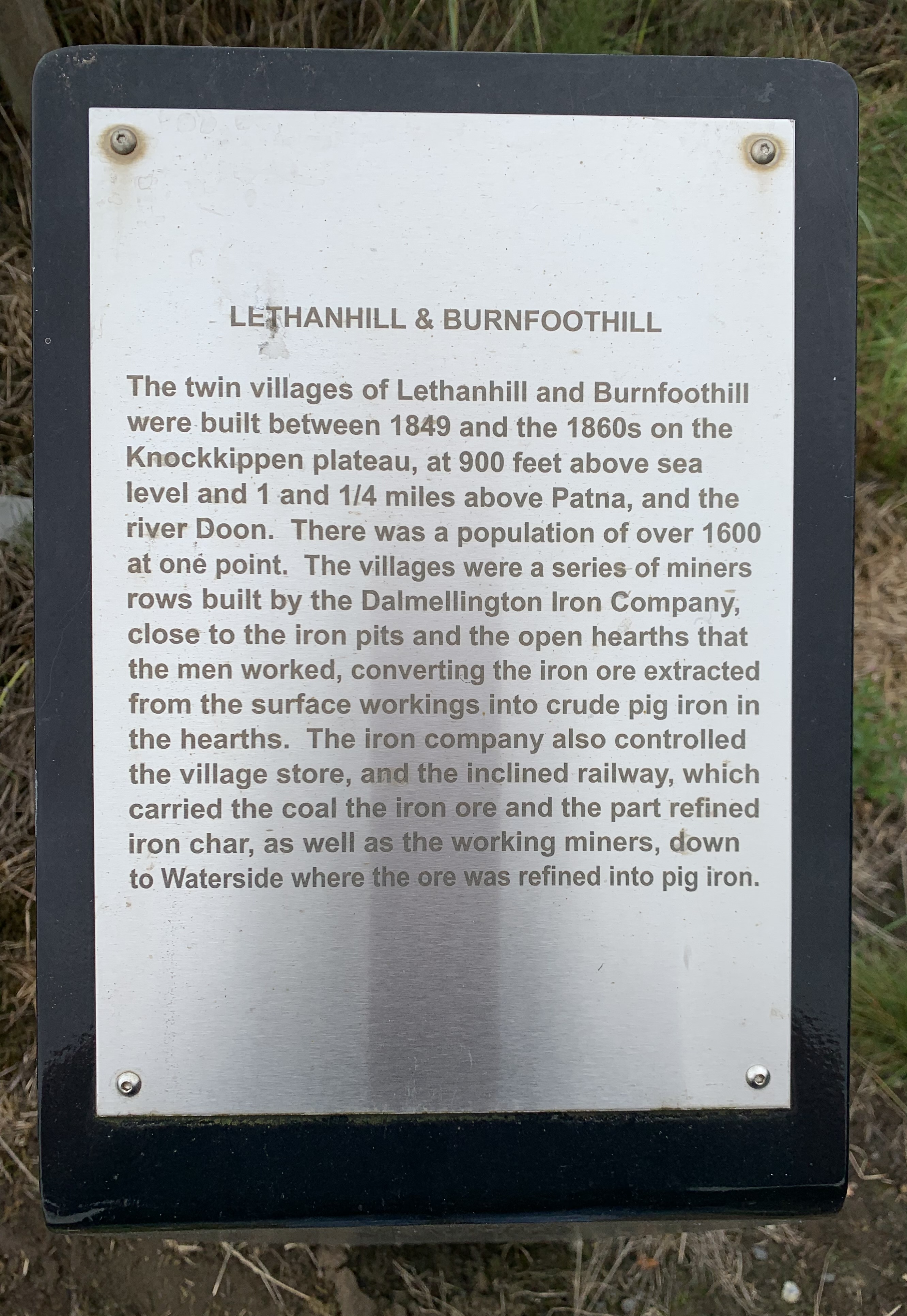
IMAGE: Plaque off the A713 marking the road up to Lethanhill and Burnfoothhill (reproduced with permission from Yvonne McFadden)
It was a damp and cloudy morning, but the rain stayed off. Parking amongst the sheep at the old schoolhouse, now a private residence, I walked up towards the crossroads to find a marker commemorating the villages.
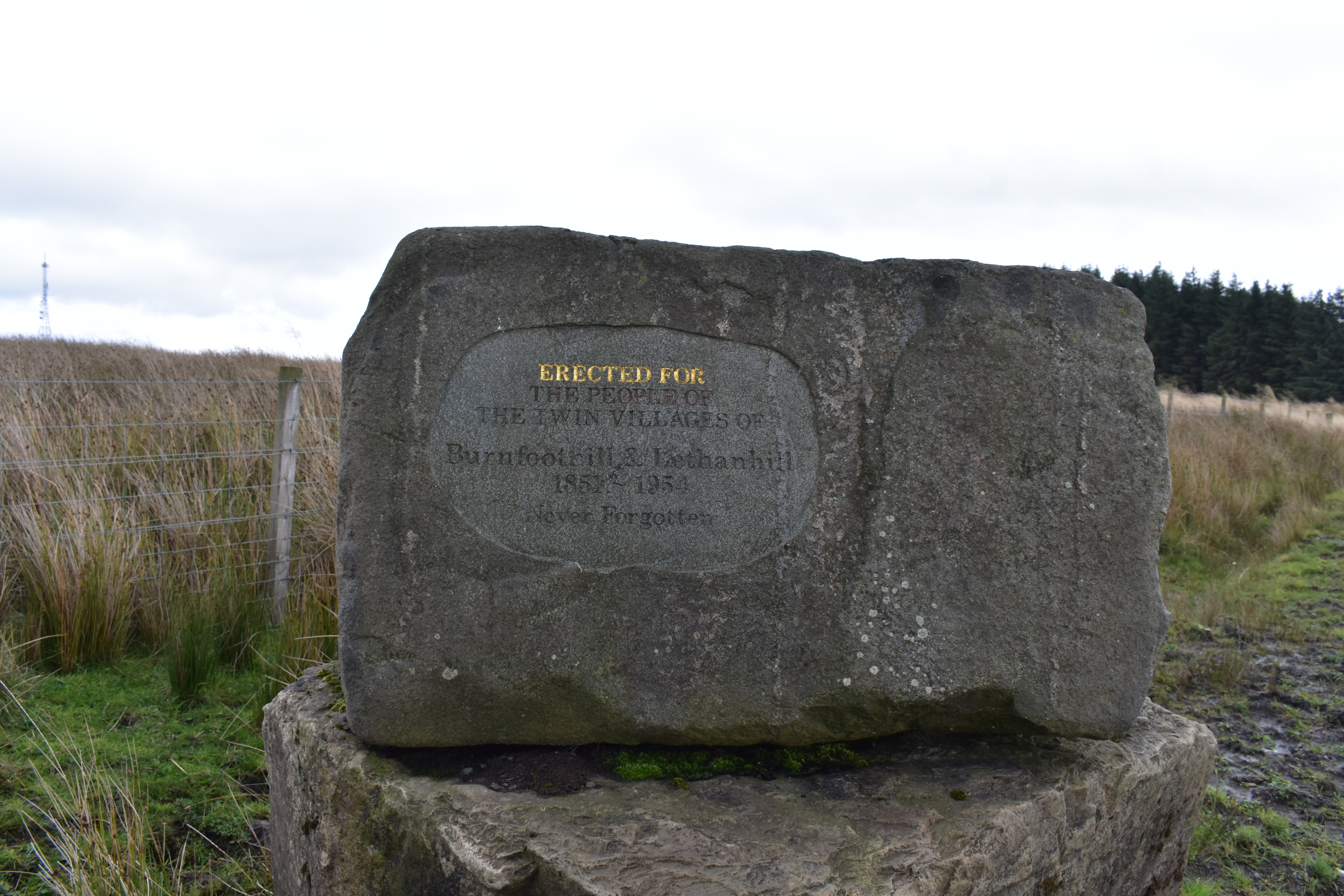
IMAGE: Stone marker at the Cross roads to commemorate those who lived in the villages of Lethanhill and Burnfoothill. (reproduced with permission from Yvonne McFadden)
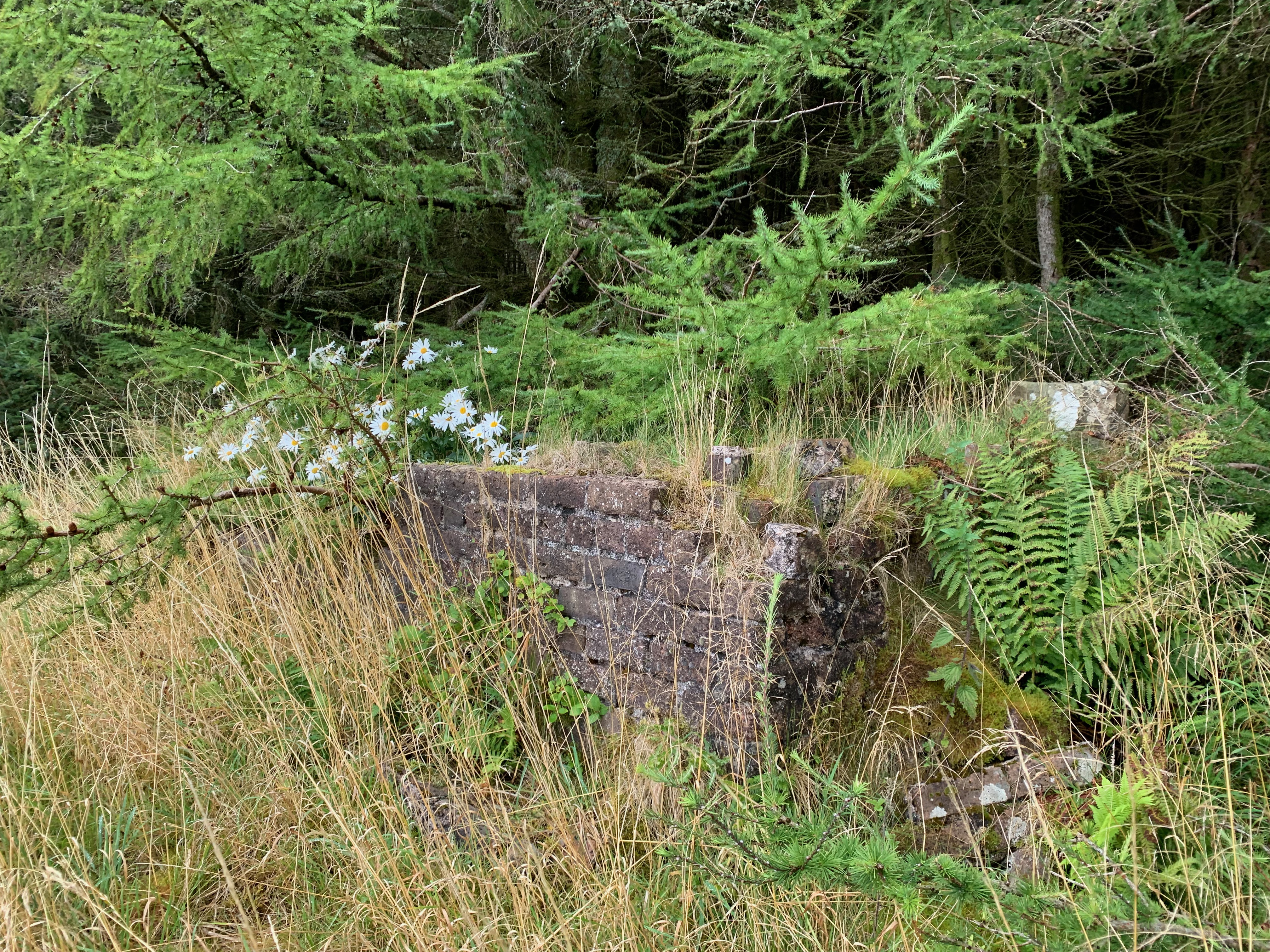
To the left, there were no remains left of the old Ponessan Row that made up Burnfoothill.
The site of the Ponessan Row, September 2021
(reproduced with permission from Yvonne McFadden)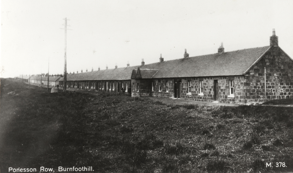
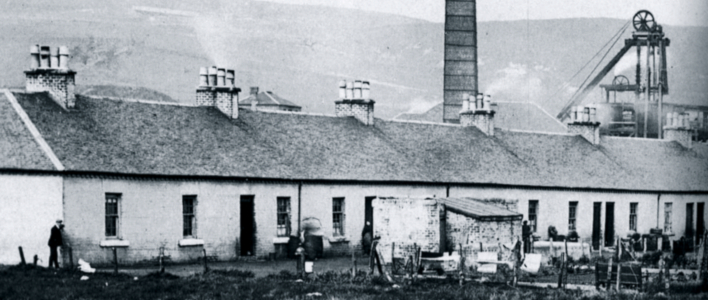
Ponessan Row, Burnfoothill from East Ayrshire Council Archives
A very short walk away, I could see the tree plantation that now covers the site of the village of Lethanhill. You get a real sense of how close these two villages were. From the road, the World War One monument was the only visible indication that there once was a village amongst the trees, grass and cows.
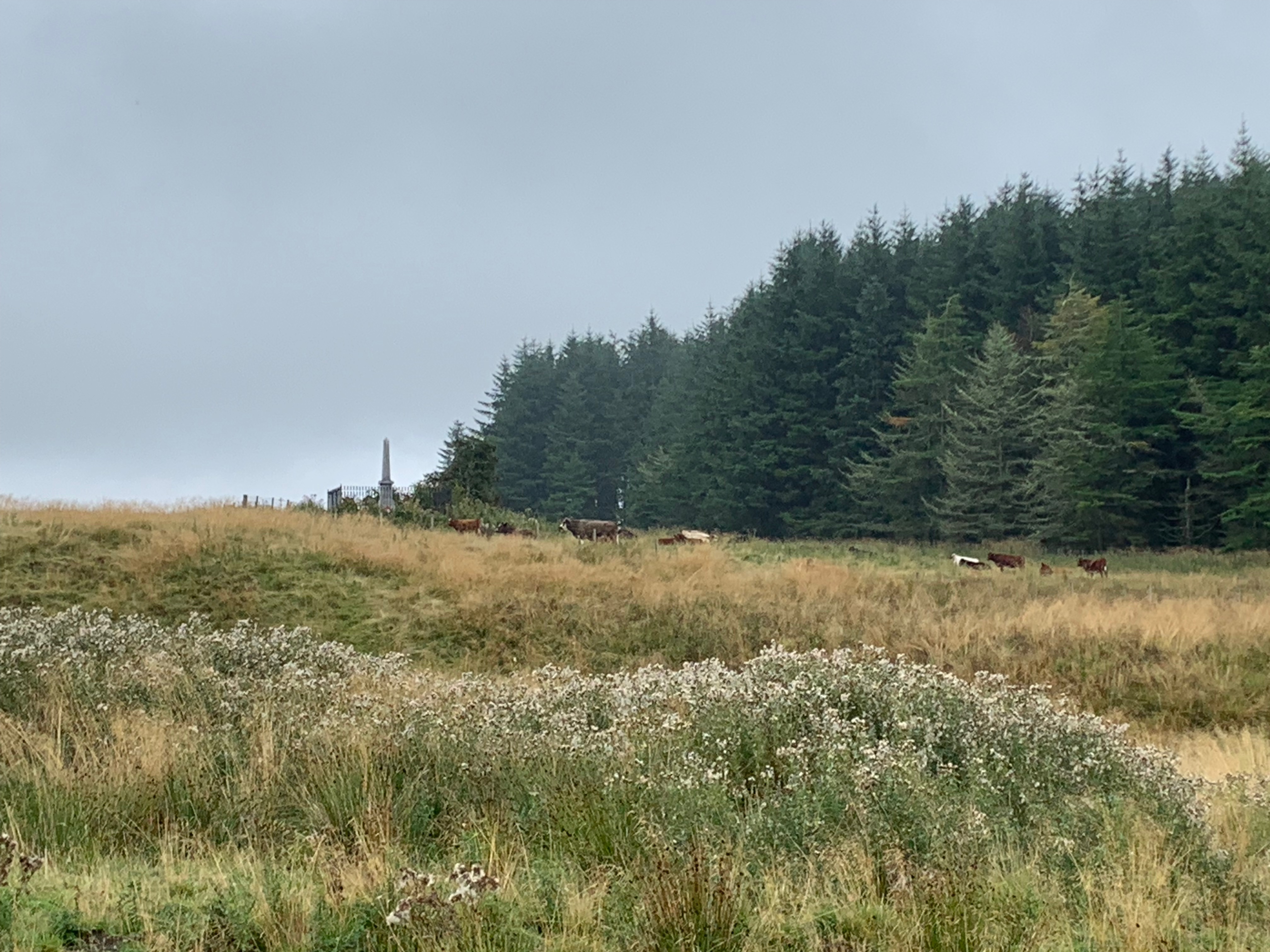
War Memorial and Tree line of the village, now a plantation 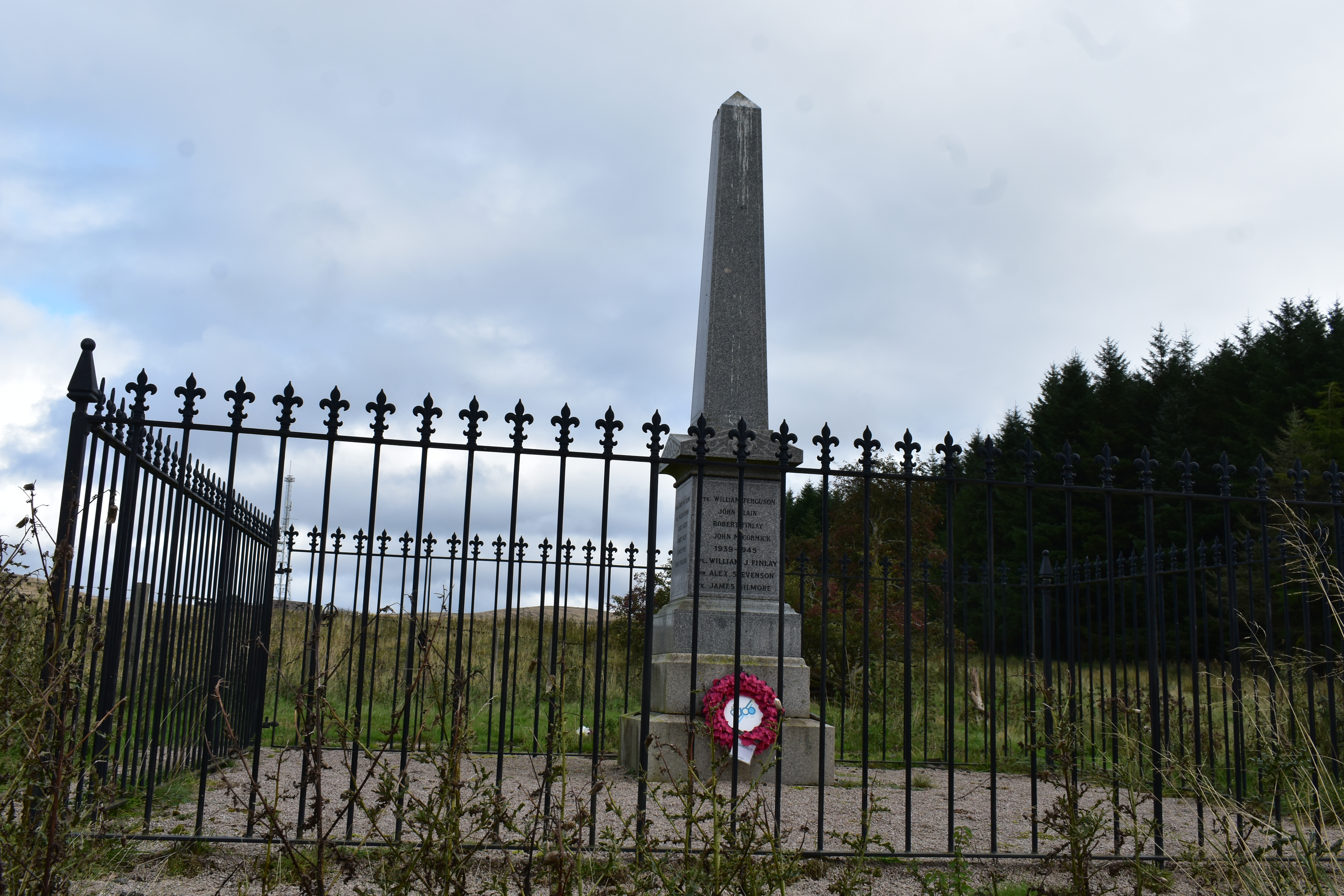
Close up for the War Memorial
(once the cows had gone)
IMAGES: Reproduced with permission of Yvonne McFadden
Armed with the excellent National Library of Scotland georeferenced historic maps on my phone and a fantastic map from Ayrshire.org below, I entered the village at the back of ‘Laight Raw’.
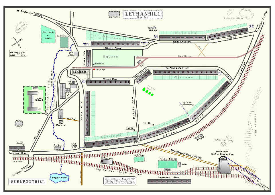
IMAGE from http://www.ayrshirehistory.org.uk/Bibliography/monos/amr5-lethanhill.htm
It was so quiet in amongst the trees and at first it seemed like all signs that this was once a large mining village with around 152 houses were now gone. Then bit by bit, I began to find signs of villages life. Under the roots of one tree was a pile of coal, red bricks began to pop out amongst the greenery. The further I walked more of the village was revealed.
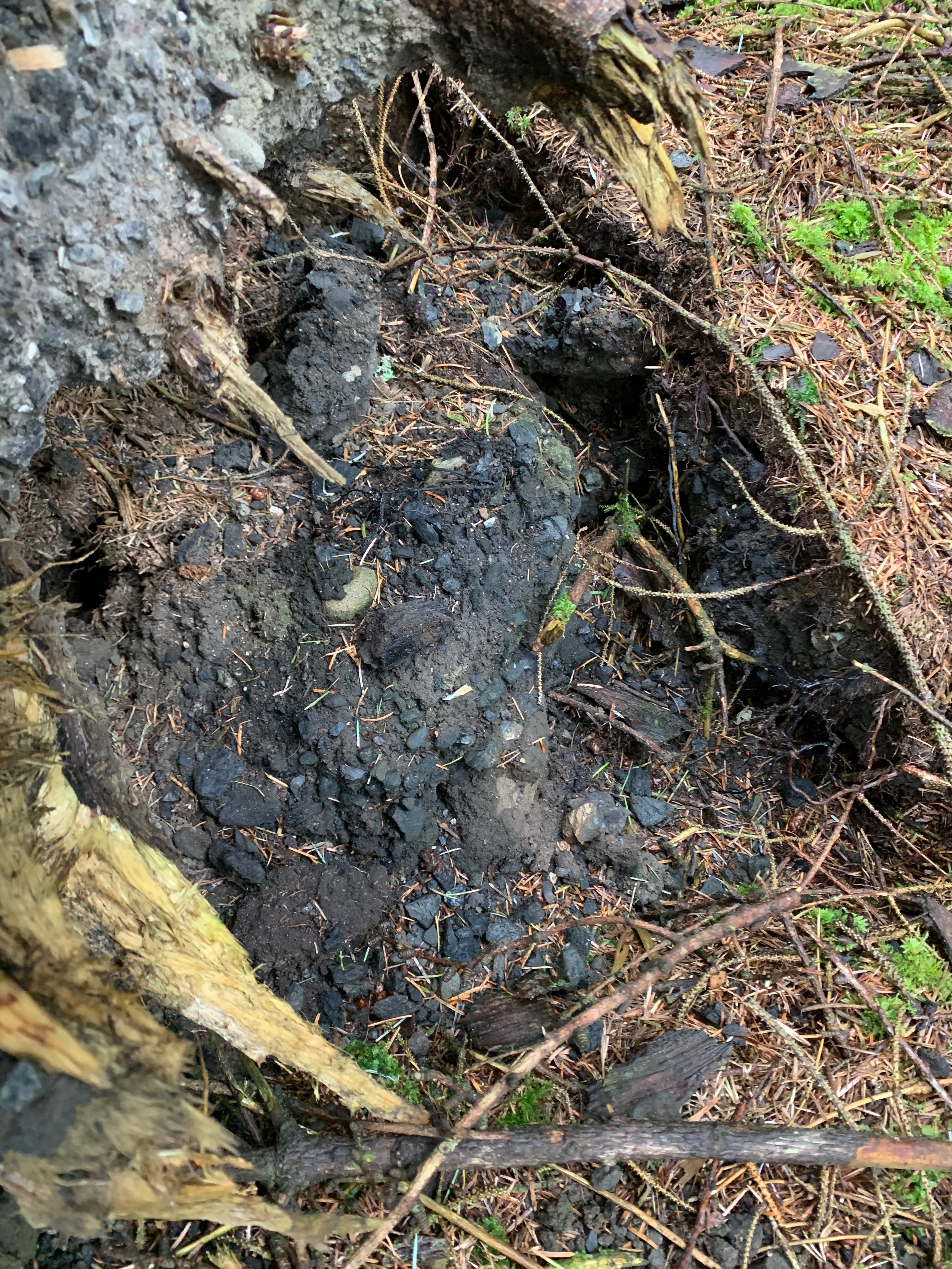
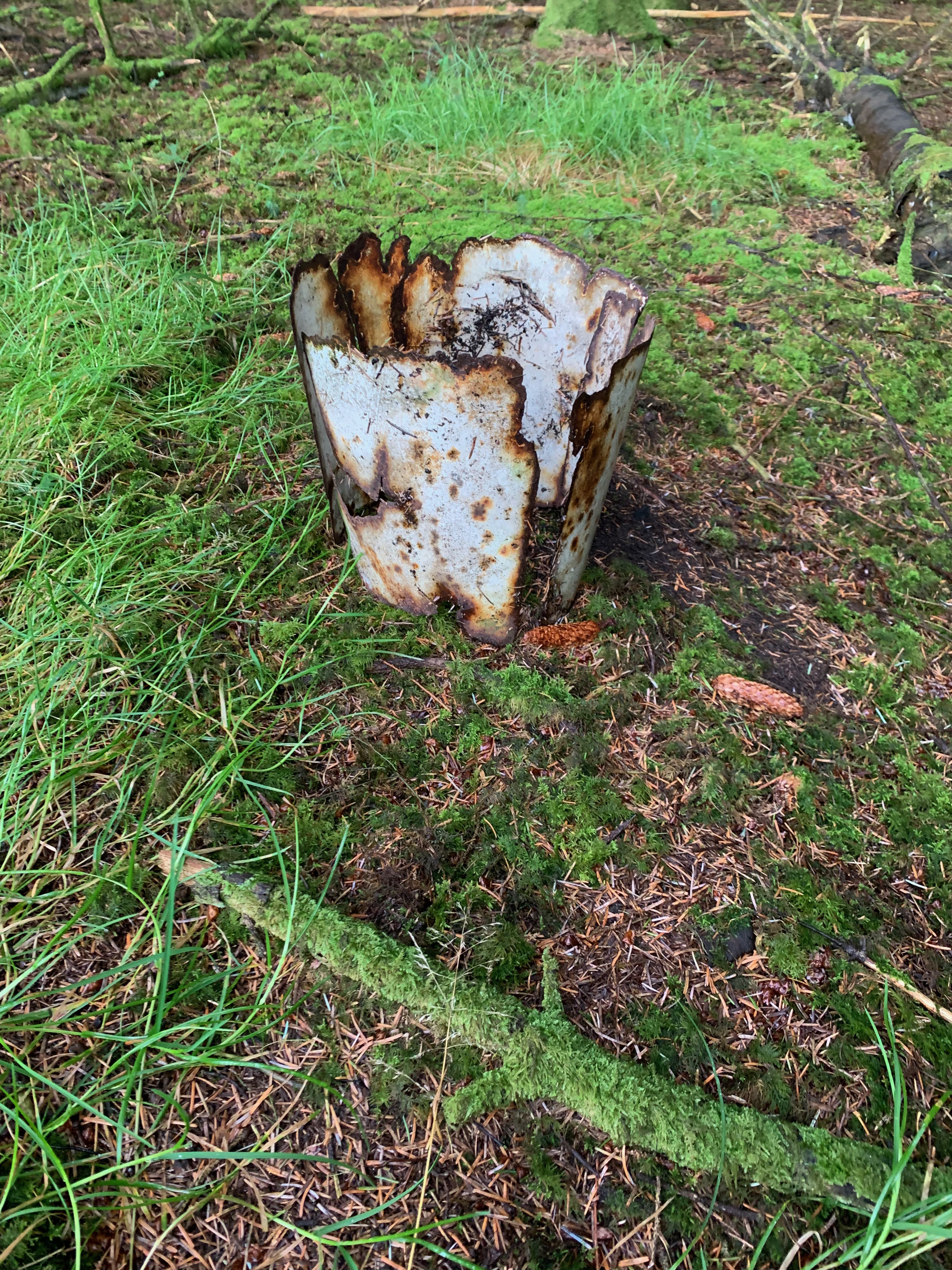
Coal under the roots of tree
IMAGE: Pile of coal under the roots of a tree. ( Reproduced with permission of Yvonne McFadden)
When I spotted my first outhouse I was very excited but little did I know that they were the main remnants still standing throughout the whole village. It seems odd to knock down the rows but not the outhouses, a job too far for the demolition crew perhaps!
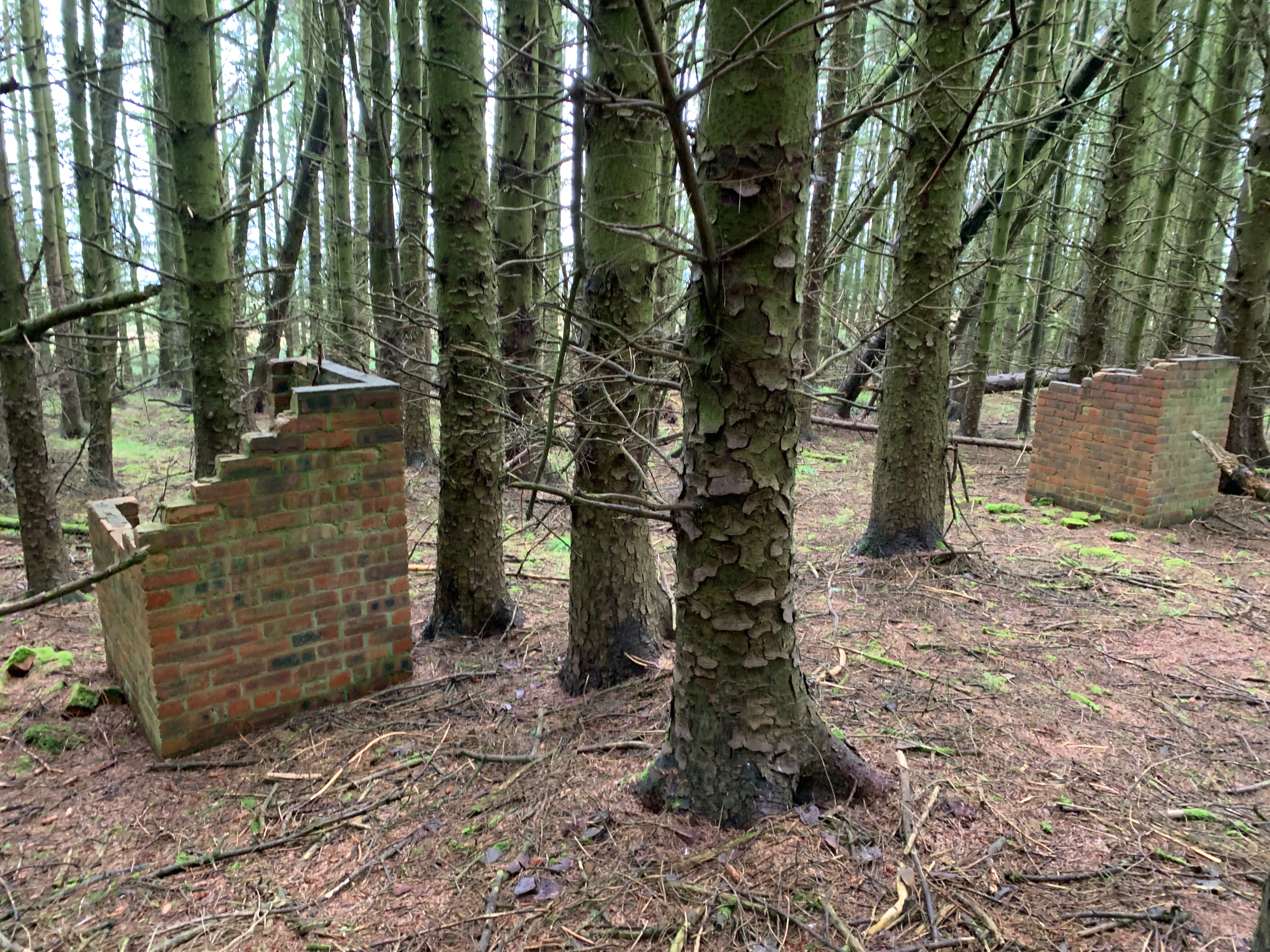
IMAGE Reproduced with permission of Yvonne McFadden
I walked up the rear of the Step Row. The remains of the sculleries were easy to identify. From the outlines of the front wall to the wall of scullery, you got a sense of how small the living spaces were. There was a moment when I got carried away after I found a scullery with a concrete floor. In an oral testimony donated to the project, we have a description of the company ‘doing up’ the house of the village maintenance joiner, John Sim. Part of this was adding a concrete base to the scullery. However, once I got back down the hill and checked out the testimony, it turns out the Sims lived in the Laight Row. Someone else must have had their house improved as well.

All images reproduced with permission from Yvonne McFadden
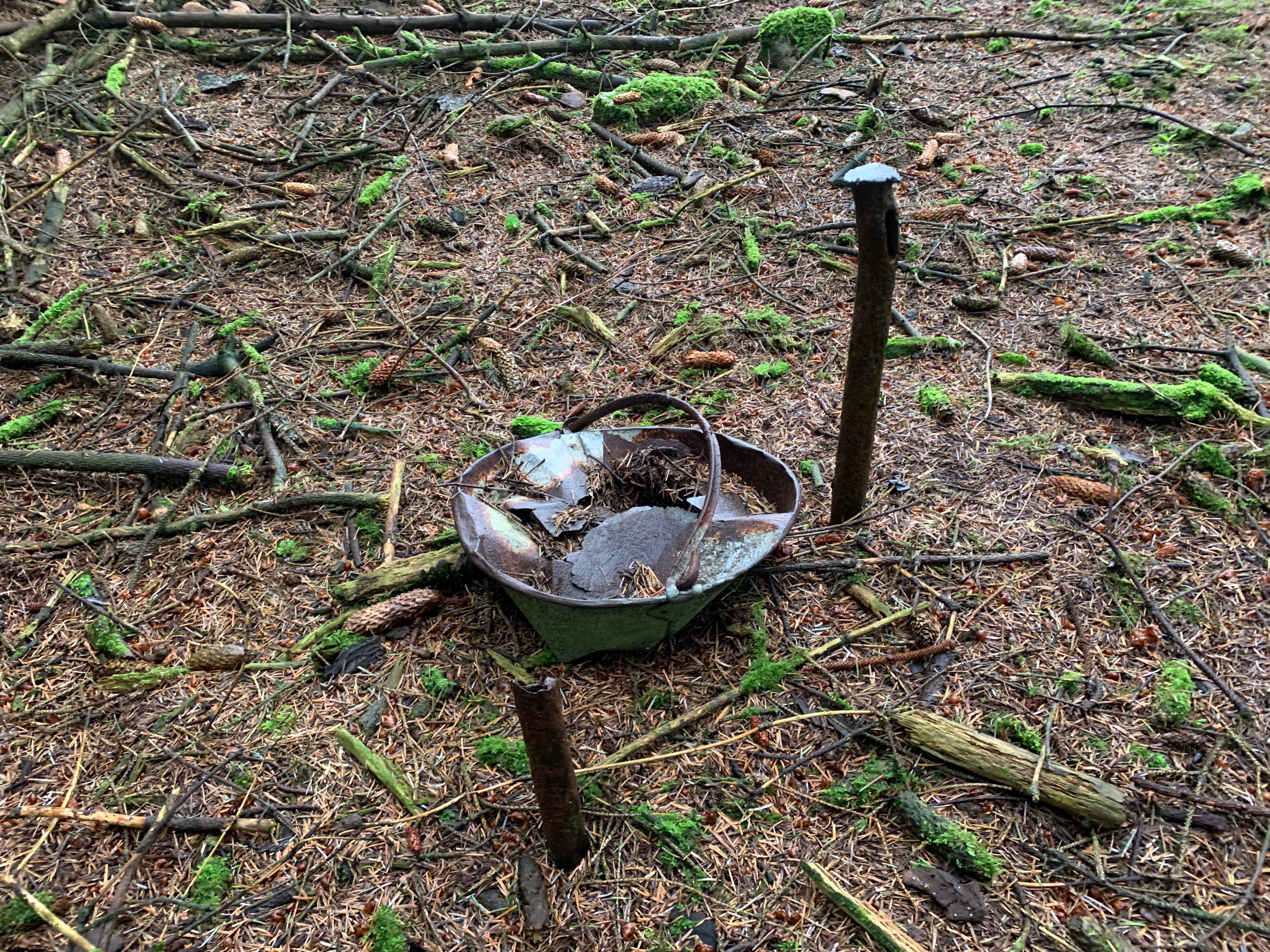
As I walked up the gardens of the Step Row, every now and then a pail would be lying at the back of the house. Other items found were cups, bottles and even some painted crockery.
At the end of the Step Row, there were some fairly well-preserved buildings that came out at an angle from the row. The door was to the side rather than to the rear. Looking at the map, this appears to be the village store at the edge of the village square. All the other housing remains appeared to have a large stone base with then two layers of brick walls. While this had a concrete roof and was roughcast. If any former residents are reading this, do you know what this building was?
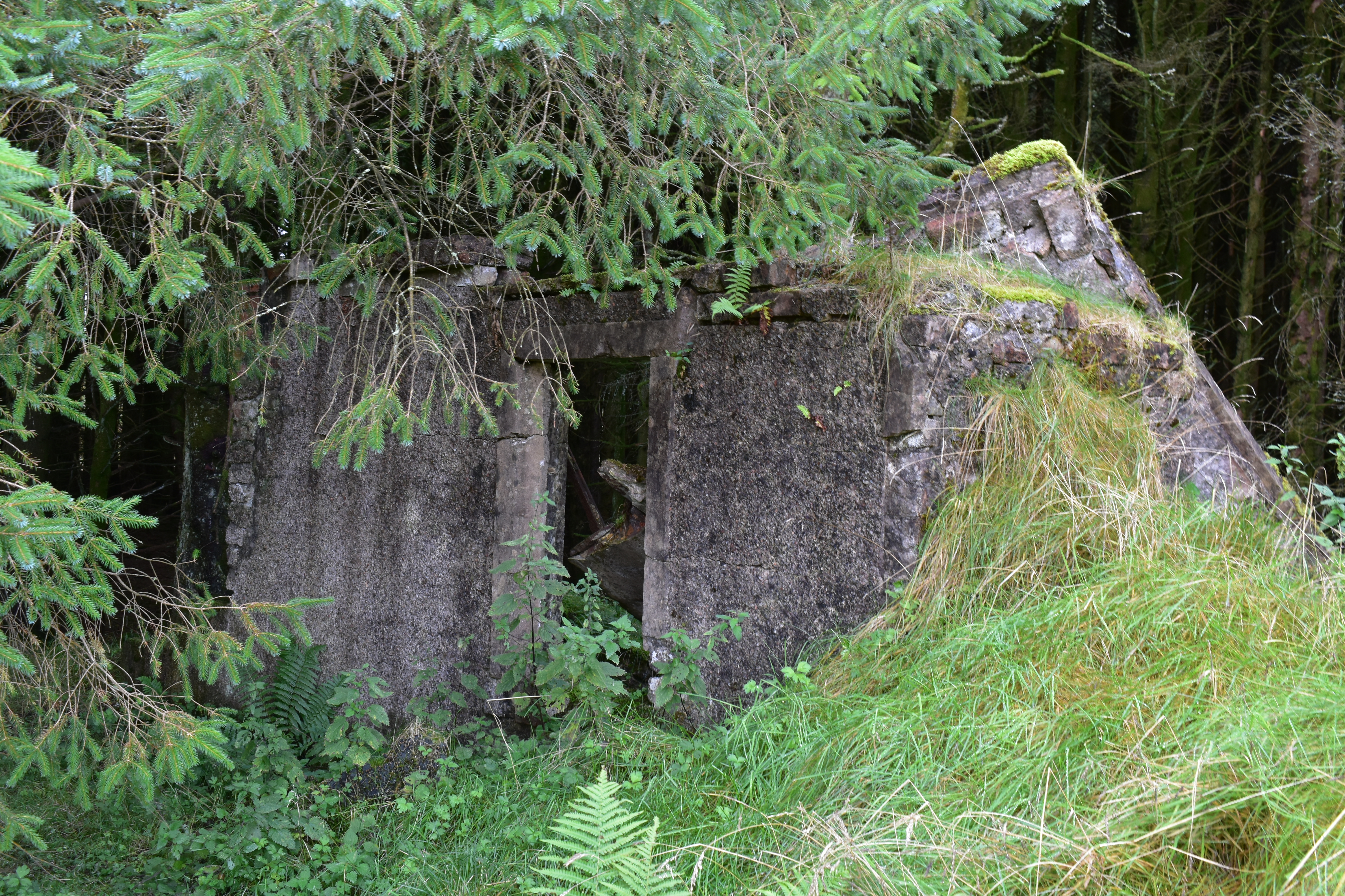
IMAGE: Could this be the village store at the top of Step Row? (reproduced with permission from Yvonne McFadden)
Outside the plantation, near the cows, was a lovely white marker, saying ‘Long Live the Hill’.
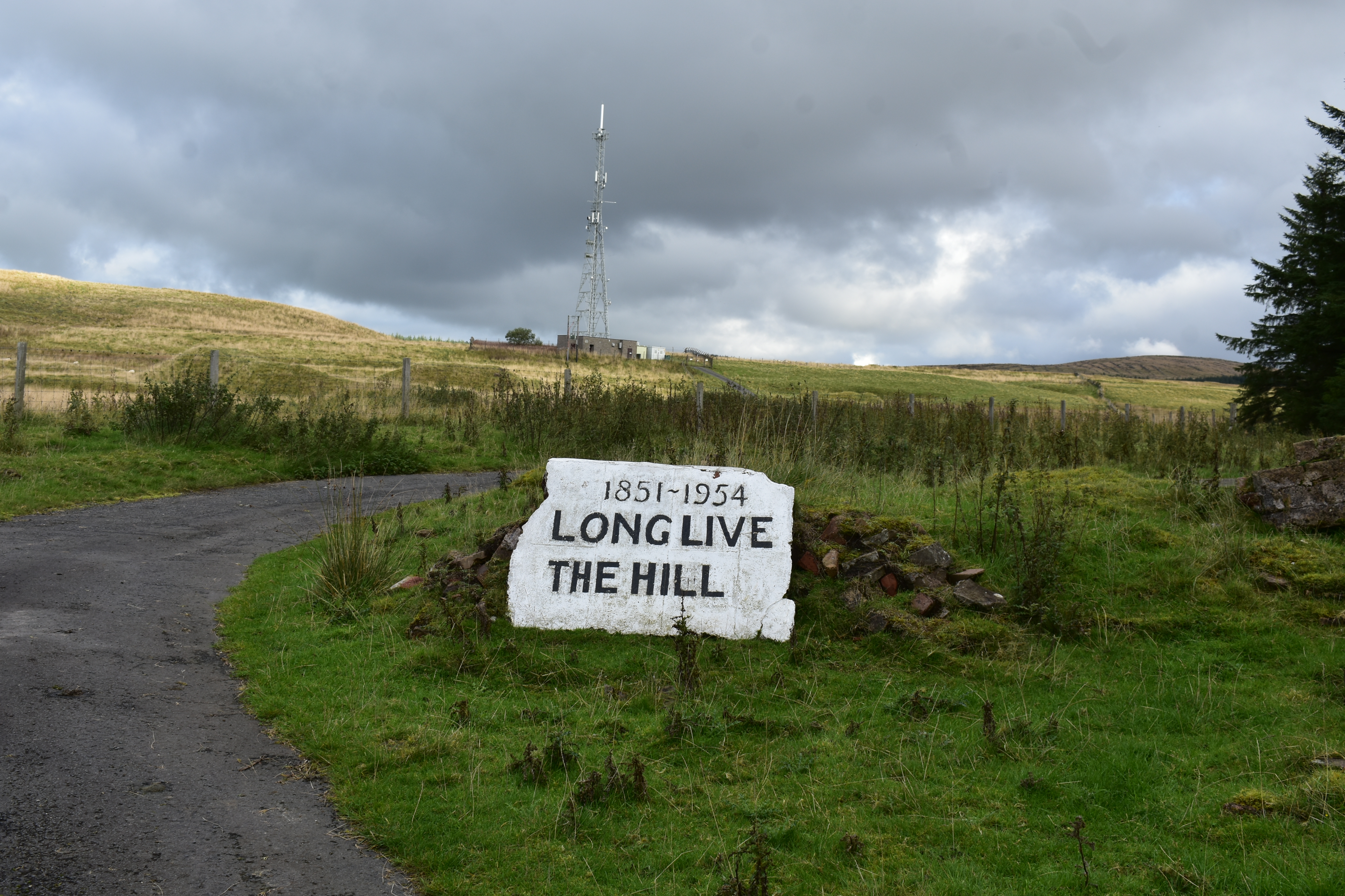
IMAGE: Long Live the Hill memorial stone (reproduced with permission from Yvonne McFadden)
Standing at the village square and looking at towards the edge of the plantation, it struck me how big this village once was. I walked across and heading down towards what I think was the Auld School House Row and there I found it! The best-preserved toilet in the village! The hinge of the door was even lying on the ground next to the building. I say toilet but going inside here you get a real sense of how basic the living conditions were.
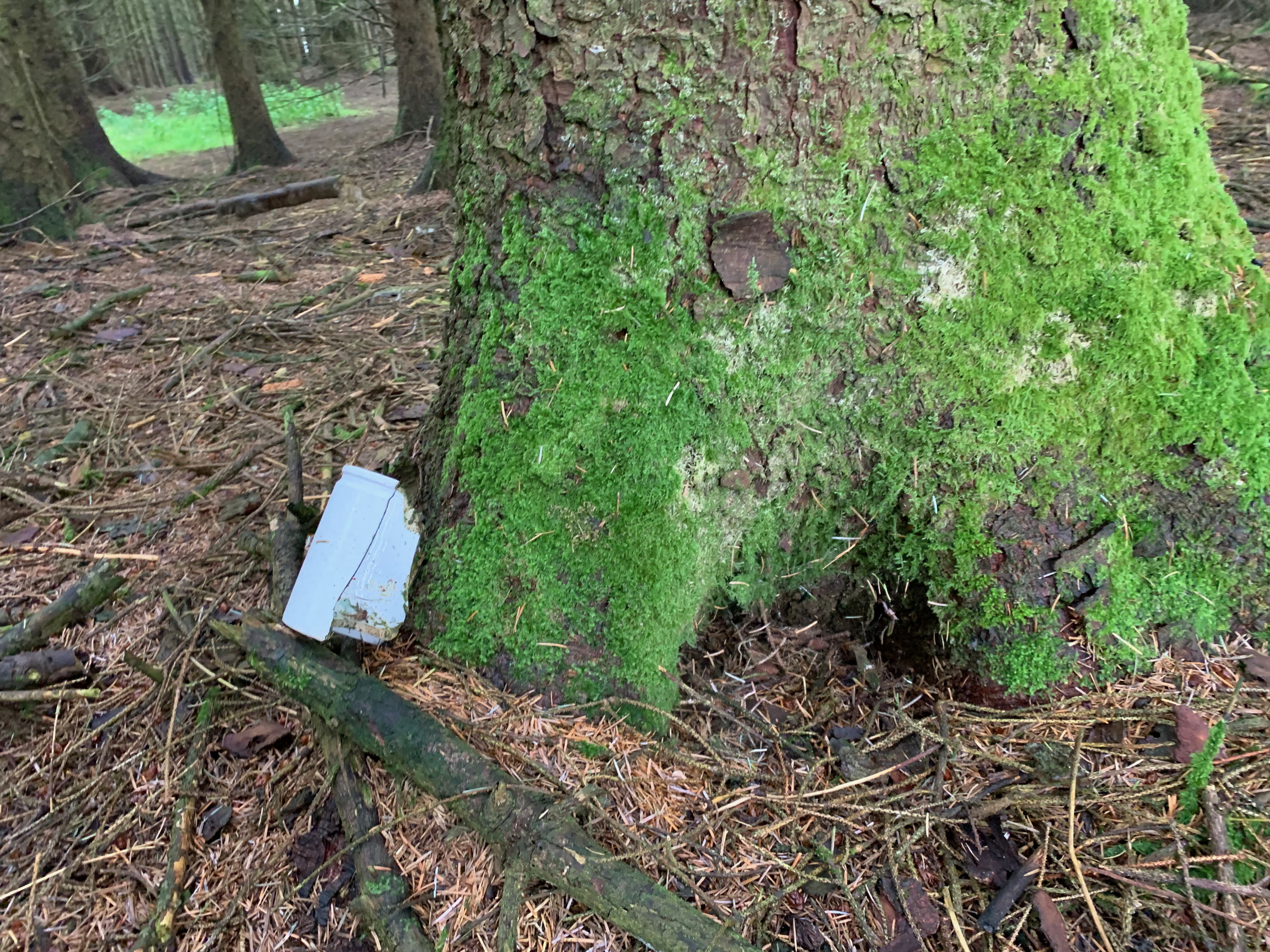
And judging by the smell I think it still fulfils its function as a facility for the visitors who had left some bottles and cans dotted about the place.
Not far from the outhouse I came across a scullery with its rear wall intact. You could see the metal brackets in the wall that supported the sink with the hole for the outflow just underneath.
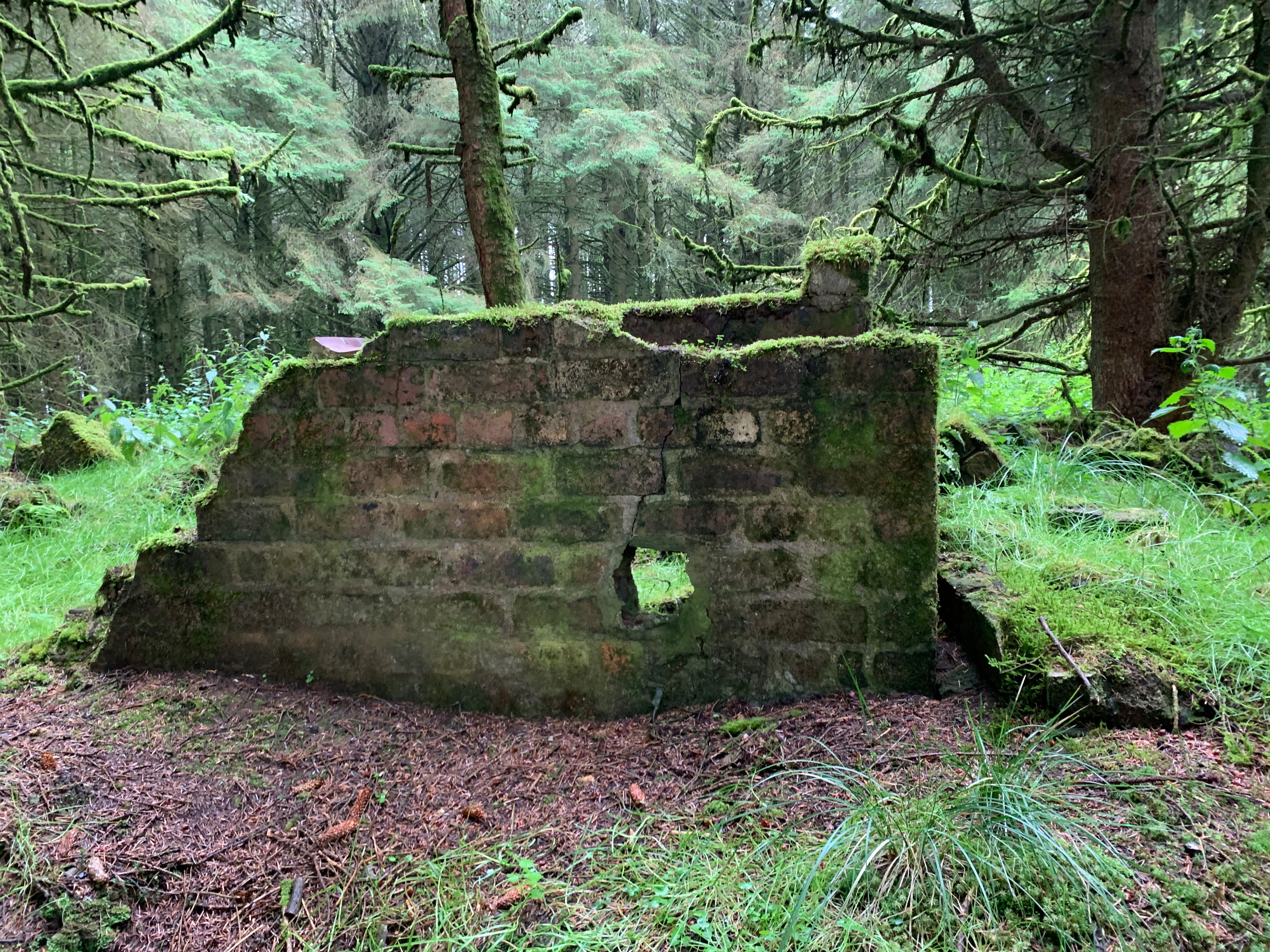
IMAGE: Rear wall of scullery with hole for sink outlet visible. Inside two brackets at either side of the whole about the width of a sink (reproduced with permission from Yvonne McFadden)
There was little evidence of pipes throughout the whole site, though there was lots of corrugated iron strewn about. As I made my way to the front of the village to the Laight Row, which hard to find when I first entered the village despite it being the longest run of houses. The houses to the far edge were clearly visible with some windows and door openings intact.
For me, the visit brought to life some of the stories I had heard about how isolated the villages were and the size of the kitchens and sculleries. As I stood at the sink brackets in the scullery – imagining a woman standing doing the dishes or a man washing off the pit dust – it reminded me of when I was a wee girl and used to visit historical sites and wondering who lived here and what was their lives like. In that moment I felt incredibly privileged and lucky to be hearing stories of what it was like to live in this village I was standing in and to be part of preserving these stories for future generations.
If this site visit has reminded you of stories about any of our Lost Villages please get in touch here
Also, you can find out more about this history of Lethanhill and Burnfoothill on our website here
By Dr Yvonne McFadden (Project Researcher)